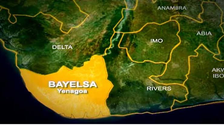
High Flood To Hit Delta, Imo, Cross River, 12 Other States In 7 Days
The Director-General and Chief Executive Officer of the Nigeria Hydrological Services Agency (NiHSA), Arch Umar Mohammed, has warned of a high risk of riverine flooding across 16 states in the next seven days.
Mohammed disclosed this on Saturday in the agency’s National Flood Advisory, noting that rising river levels could trigger flooding in several communities and put schools, healthcare facilities, markets, farms and religious buildings at risk.
He urged state governments to urgently relocate residents living in vulnerable communities to safer, higher grounds ahead of the anticipated flooding.
The NiHSA chief said the affected areas included parts of Imo, Cross River, Ebonyi, Benue, Anambra and Akwa Ibom states, among others. He advised communities located on floodplains to prepare for possible evacuation, identifying Obubra, Itigidi and Epento in Cross River State as locations where rising river levels were expected.
In Imo State, the affected local government areas are Aboh-Mbaise, Ahiazu-Mbaise, Ehime Mbano, Ezinihitte, Ideato North, Ihitte/Uboma and Ikeduru. The agency identified 958 communities, 1,022 schools, 553 healthcare facilities, 161 markets and 198 religious buildings as being exposed to the flood risk.
In Cross River State, the affected LGAs include Abi, Akamkpa, Akpabuyo, Biase, Calabar, Calabar South, Ikom and Obubra. According to NiHSA, 2,471 communities, 703 schools, 344 healthcare facilities, 145 markets, 453 religious buildings and 854 hectares of farmland are at risk.
The agency also listed Abakaliki, Afikpo, Afikpo South, Ebonyi, Ezza North and Ezza South LGAs in Ebonyi State among the affected areas. The exposure figures include 2,574 communities, 1,064 schools, 422 healthcare facilities, 480 markets, 629 religious buildings and 1,882 hectares of farmland.
In Benue State, Buruku, Gboko, Guma, Katsina-Ala, Logo and Ukum LGAs were identified as vulnerable, with 303 communities, 100 schools, 48 healthcare facilities, 32 markets, 151 religious buildings and 55 hectares of farmland exposed to flooding.
Other affected areas include Aguata, Anambra East, Anambra West, Anaocha, Awka North, Awka South and Ayamelum LGAs in Anambra State. NiHSA identified 1,314 communities, 1,308 schools, 1,089 healthcare facilities, 280 markets, 610 religious buildings and 1,529 hectares of farmland as exposed.
In Akwa Ibom State, the affected LGAs are Abak, Eket, Etinan, Ibeno, Ibesikpo Asutan, Ibiono Ibom, Ika and Ikono. The agency listed 249 communities, 323 schools, 211 healthcare facilities, 74 markets and 289 religious buildings among the assets at risk.
NiHSA further identified Edo, Bayelsa, Enugu, Kogi, Delta, Abia, Taraba, Rivers and Lagos states as other areas facing severe flood risks during the forecast period.
9/20/2026, 7:14:57 AM
views 4927
2464